


|
|
|||||||
 Click to enlarge Click to enlarge
|
Description
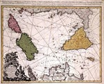
Plate belonging to the Geographical Atlas of the Kingdom of the Two Siciles that represents the first maritime atlas of the world. It was drawn by Giovanni Antonio Rizzi Zannoniwho studied astronomy from 1749 to 1753 at the University of Padua as student of Giovanni Poleni. |
||||||
| Linked items | |||||||
|
|||||||
| Permanent links | |||||||
|
|
|||||||
| Data provider | |||||||
|
|
|||||||