para ir a la página principal de DMG-Lib
Home  · Mapa del sitio  · Contacto  ·

Búsqueda avanzada   Búsqueda de mecanismos

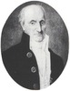
Rizzi Zannoni, Giovanni Antonio (1736 - 1814)


Engineer, Cartographer

Giovanni Antonio Rizzi Zannoni from 1749 to 1753 astronomy at the University of Padua as student of Giovanni Poleni. In 1753 was invited in Poland by king Augustus III to design a map of the whole Poland; the latter was judged much better than the ones that had been designed before. He was then invited in Sweden, Danemark and Prussia to draw maps of those Nations. Later was appuinted Hydrographer Engineer of Paris. In 1781 till he dead was back in Naples where he designed the Geographical Atlas of the Kingdom of the Two Siciles that represents the first maritime atlas of the world. In Naples he founded the Neapolitan School of Cartography.
   
diversas escrituras:
Rizzi Zannoni, Giovanni Antonio
   
Curriculum vitae  
* 02.09.1736 Padova nacido
1749 - 1753 Padova Studies astronomy at the University of Padua
1753 Starts the career of cartographer in Poland
1756 Works as cartographer in Sweden and Danemark
1769 Draws a map of the Kingdom of the Two Siciles
1772 - 1774 Hydrographer Engineer of Paris
1781 - 1812 Napoli He is Back to Naples where draws a complete Geographical Atlas of the Kingdom of the Two Siciles
† 20.05.1814 Napoli fallecido
Collections
Comienzo de la era moderna, 1500-1780
Revolución Industrial, 1780-1850
Imágenes
 
Portrait_Rizzi Zannoni
Pinche para ampliar
Rizzi Zannoni_Atlas 1
Pinche para ampliar
Rizzi Zannoni_Atlas 2
Pinche para ampliar
Permanent links
DMG-Lib FaviconDMG-Lib https://www.dmg-lib.org/dmglib/handler?biogr=13250004
Europeana FaviconEuropeana  http://www.europeana.eu/portal/record/2020801/dmglib_handler_biogr_13250004.html
×